UAS Topographic Surveying
- Home
- UAS Topographic Surveying
Experts in the Latest Survey Technology to Increase Productivity, Safety and Client Satisfaction
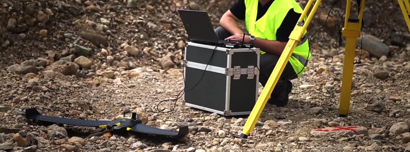
Alphatec Surveyors is the leader in the Southeast Virginia region for the latest surveying and mapping technology. We are all about delivering the highest quality service and products in the fastest possible time for our clients who require topographic engineering and construction surveys. Alphatec Surveyors uses the combination of cutting-edge GPS and unmanned aerial systems (UAS) for large area 3D digital terrain modeling and aerial imagery mapping. We produce and deliver detailed topographic 3D models, survey photography and orthophotography.
Topographic Surveys
Our topographic surveys determine the relative boundary and locations of various elevation points on the earth’s surface found at construction or mining sites and even buildings. The process involves setting plot points throughout a boundary area using conventional surveying and/or our unmanned aerial system to determine 3D modeling data. That data is then digitally processed measuring the area's horizontal distances, differences in elevation and the directions both face. Essentially creating a 3D representation of the surveyed area.
The data serves as a base map for the design and/or excavation of different types of construction projects. We then provide the data required for the effective, accurate and efficient building of a residential home or plotting the boundary of a lot as well as civil and commercial applications for large buildings, complexes, parking lots, roads and driveways.
Benefits of an Unmanned Aerial Survey System
Eliminates the potential of injury in high-risk or high traffic areas. UAS surveying requires only a minimal number of personnel that are in the area for less time.
Our aerial surveying system allows hundreds and even thousands of acres to be accurately and efficiently surveyed in the time only tens of acres could in the past using conventional means. Traditional surveying took teams of people days and weeks to perform large scale surveying; Our UAS surveying greatly reduces required manpower down to one or two people.
Savings in several areas - relatively minimal UAS set up time and cost; accurate survey results can be generated in as little as 30 minutes; our better allocation of personnel resources allows us to be highly responsive to be on-site for you within immediate travel time when you call us.
The system provides better information where data and photography is combined with accurate topographic data, digital 3D terrain modeling and volumetric analysis. Data elevation models are measured in the range of millimeters. When a DEM is created at each site surveyed, a ground truth survey is also performed to determine the accuracy of the model. These highly accurate DEMs can be used to create a wide range of products unique to the landscape surveyed.
The UAS system can provide fast up-to-date data to improve decision making.
SURVEYING FLOOD RISKS
Our UAS surveys can be used to assess water accumulation and flow direction for flood management projects. The technology has made a substantial contribution in flood monitoring and flood damage assessment. Its proven to be a popular means of providing an accurate hydrologic analysis by mapping terrain elevations in identifying and managing flood prone areas.
CONSTRUCTION SURVEY APPLICATIONS
- Benchmark and Leveling
- As Constructed - As Built
- Volume
- Agriculture
- Road & Rail
- Oil and Gas
- Mining
- Powerline Monitoring
- Infrastructure
- Construction
- Deformation Surveys
- Flood Management
- County / City Planning
- Real Estate / Development
- Pipeline Monitoring
- Building or Structure Monitoring
- Insurance – Damage Assessement
- Archeology
